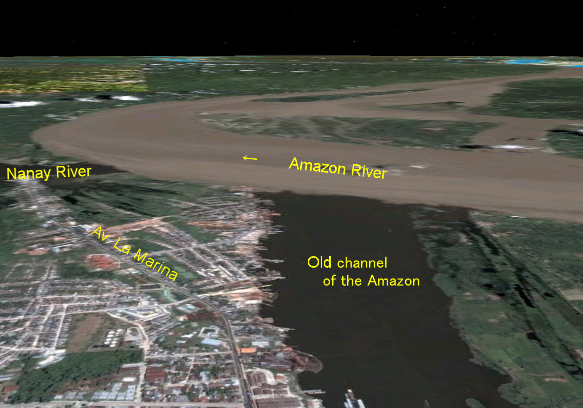
This three-dimensional view of the Google Earth satellite image is almost the same location as the photo on page 7 of the main text (PanoraGeo-No. 222, taken in 1981), 25 years later.
During this time, many changes have taken place. In the center of the left edge of the photo is the port of the Nanay River, and Av. La Marina Street leading to the port has been paved.
With the expansion of the city, this area is also becoming a residential area. Iquitos grew into a city of about 500,000 people.
However, even such human activities seem small in the face of the power of nature. The course of the Amazon River changed in the upper reaches of Iquitos. The large, meandering brown stream engulfed the lower reaches of the Nanay River and large tracts of land near its confluence. The water in the canal along the city of Iquitos has turned black. This is due to the fact that the brown, turbid waters of the main Amazon River no longer flow here, but only from Río Itaya, a tributary of the "black water" similar to the Nanay River. Due to the accumulation of sediment along the right bank, the width of the channel has also decreased considerably.
Explanatory material for No.28. Follow the Immense River, the Amazon P.7