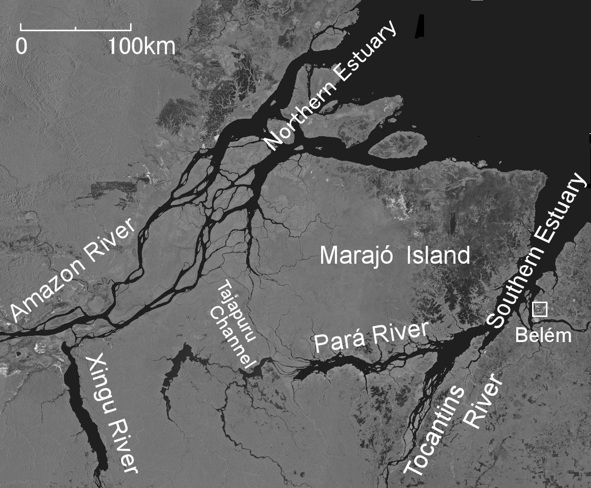
At the mouth of the Amazon is the Northern Estuary where the Amazon River pours into it, and the Southern Estuary where the Pará and Tocantins Rivers pour, with the island of Marajó lying in between. To the west of Marajó Island, there are several waterways, including the Tajapuru Channel, which separate the island from the mainland. Some of the water of the Amazon flows into the Southern Estuary through these channels, so the North and South Estuaries are not completely unrelated. However, since the amount of water flowing into the Southern Estuary is small, it is impossible to call the entire Northern and Southern Estuary the mouth of the Amazon. It is better to consider that the mouth of the Amazon is a Northern Estuary.
In addition, there are many atlases that depict the channels west of Marajó Island quite thickly, but in reality, it is thin as shown in this satellite image. Even the largest waterway, the Tajapuru Channell, is less than 400m wide at its narrowest point. It is difficult to decide whether to call Marajó Island an ‘island’ or a ‘peninsula’ In this satellite image, a darkened area can be seen in the eastern part of Marajó Island, which is a swampy grassland called Campo do Marajó, Marajo grassland. In contrast, the grey part of the west is forest.
Satellite image: JAXA, Earth Resource Satellite Fuyoh No.1, Image acquisition in 1995.
Explanatory material for No.28. Follow the Immense River, the Amazon P.19, 20