(1) 1985 Amazon River satellite image near Iquitos

(2) 2005 Amazon River satellite image near Iquitos
|
(1) 1985 Amazon River satellite image near Iquitos |
(2) 2005 Amazon River satellite image near Iquitos |
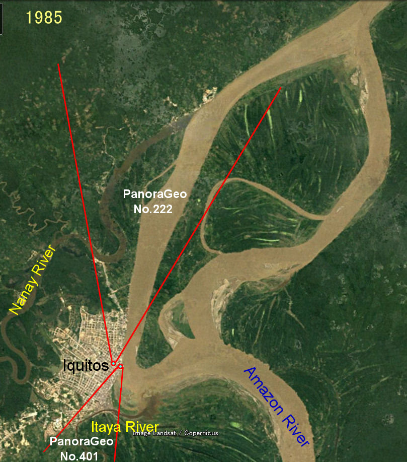
(1) is a 1985 Google Earth image, which is from the same time as the photo on page 7 (PanoraGeo-No. 222) and the photo on page 8 (PanoraGeo-No. 401). The red color indicates the shooting location, direction, and angle of view of each photo. The Amazon River, which flows northward (from bottom to top), splits into two large branches in front of the city of Iquitos (east), one of which flows along the city. Iquitos was a city on the Amazon River.
(2) is a satellite image taken 20 years later in 2005. During this time, the course of the Amazon River changed drastically, and it moved away from the city of Iquitos. The surface of the water, which borders the city where the brown murky waters of the Amazon River once flowed, is now a lake filled with black water flowing from a small river called the Itaya River. A peninsula north of the city, between the Nanay and Amazon Rivers (near the letter 'Pano....' in a 1985 photo) disappeared at once. This drastic change in the flow path is a characteristic of the upper reaches of the Amazon River. Since the city center of Iquitos is located on a upland, it is unlikely that it will disappear all at once, but there is a good chance that the floodplain urban area created by the expansion of the city will be damaged at once.
Over the past 20 years, the course of the Amazon River has changed significantly, but the course of the Nanay and Itaya Rivers, which are black rivers with little sediment, has remained largely unchanged.
Explanatory material for No.28. Follow the Immense River, the Amazon P.8