Where the Amazon River is particularly deep(m)


 |
 |
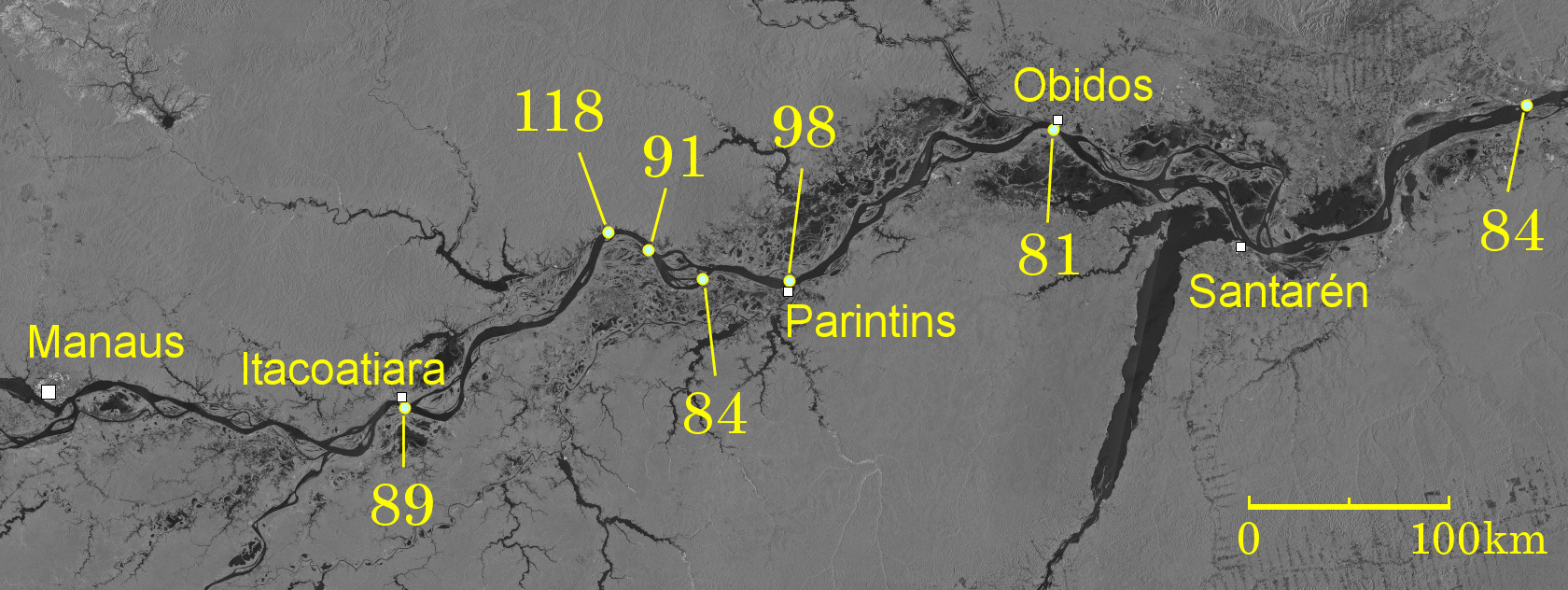
One of the characteristics of the middle Amazon River is its depth. The numbers in the satellite image above are in depth (m), which is extracted from the Brazilian Navy's Amazon River pilotage map where the water depth is particularly large*1). Where the river is less than 2 km wide such as off the coast of Itacoatiara and Óbidos (both rivers are about 1.7 km wide), the water depth exceeds 80 m, and in some places it is more than 100 m. Even if it is not particularly deep like this, it is 60 m. This is because the riverbed is severely wore away by flowing water. The elevation of the Amazon River in this vicinity is about 15 meters, which means that the riverbed is being carved much deeper than sea level by strong currents.
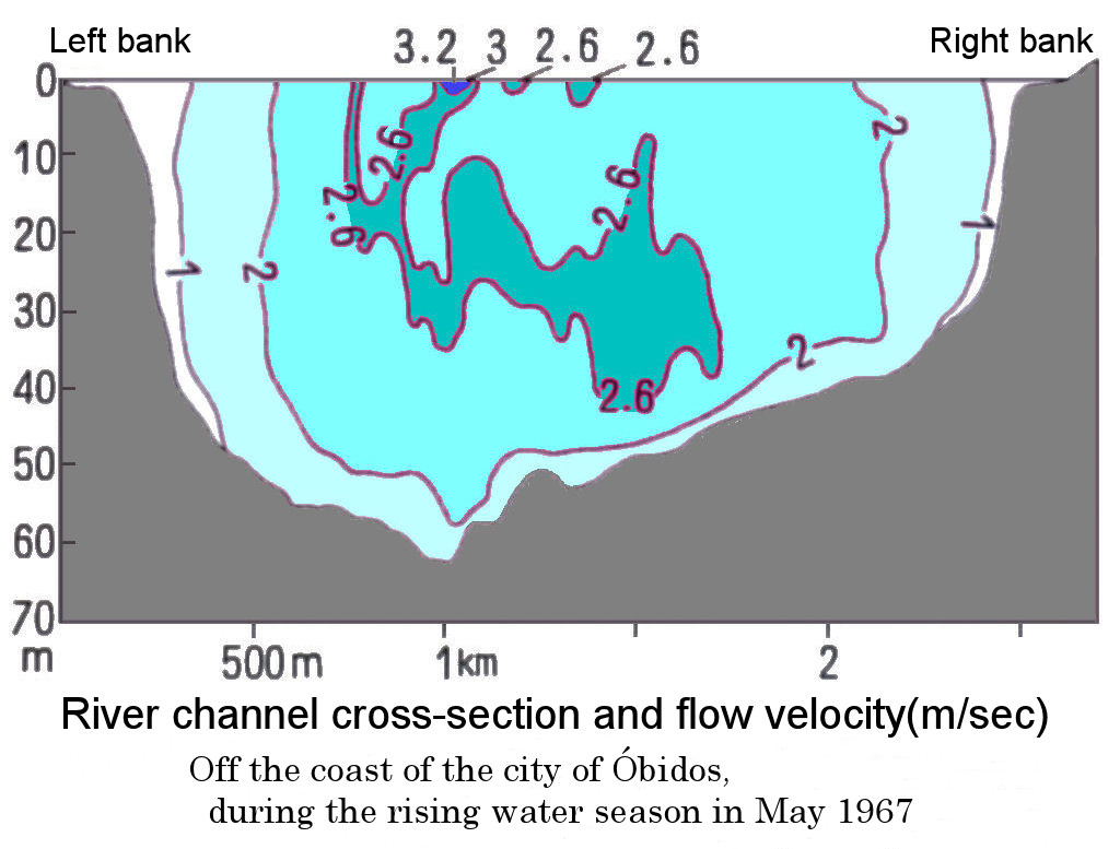
The flow of the Amazon is so fast that it is hard to imagine from its gentle gradient. As shown in the figure on the lower left, the velocity reaches 3 meters per second (about 10 kilometers per hour) in the center of the gutter-shaped channel. Small boats on the Amazon have no choice but to sail near the banks of the river, where the flow velocity is small.
*1) Castro Soares, L. de (1977):in IBGE: Geografia do Brasil Vol.1, Região Norte. Satellite image: JAXA, Earth Resource Satellite Fuyoh No.1, Image acquisition in 1995.
Explanatory material for No.28. Follow the Immense River, the Amazon P.13