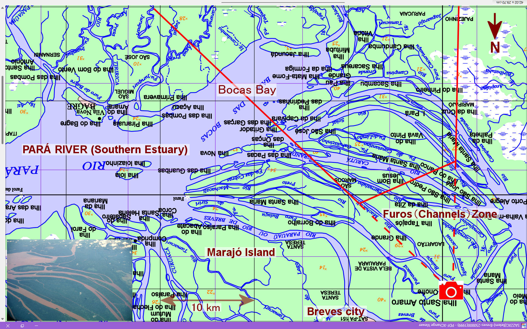
It is part of the 1:250,000 topographic map Breves sheet published by the Brazilian Institute of Geography and Statistics (IBGE). For ease of comparison with the photo on page 20 of the main text (a miniature photo of the same thing in the lower left corner of the map), the north-south is reversed (the top is south). The fan shape of the red line is the area shown in this photo. The elevation is indicated in red numbers on the islands between the waterways.
Original sheet:1:250,000 topographic map - BREVES sheet published by IBGE in 1999.
Explanatory material for No.28. Follow the Immense River, the Amazon P.20