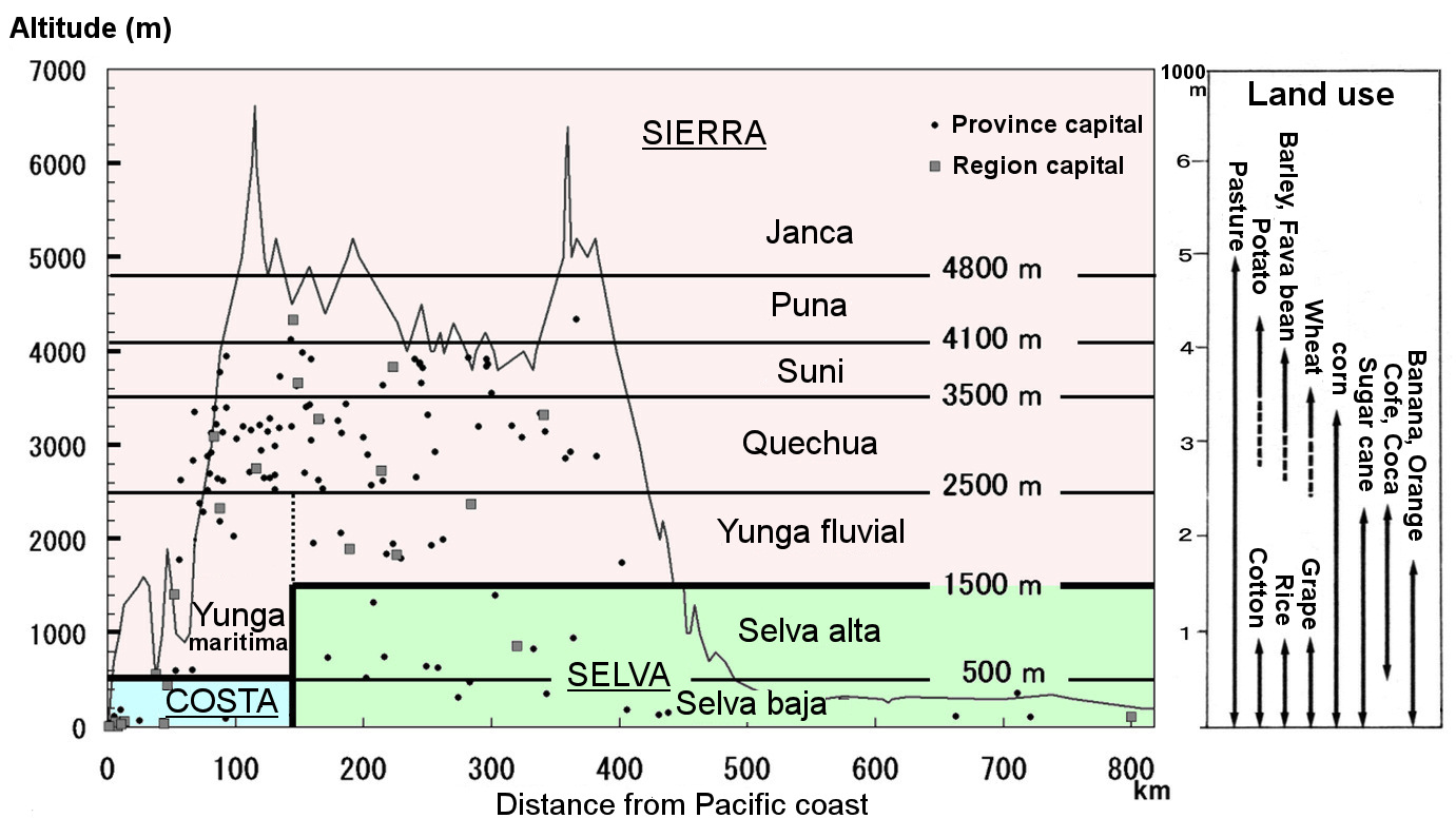
Peru has traditionally been divided into three geographical divisions: the coastal division (Costa), the mountainous division (Sierra), and the forest division (Selva), but the geographer Javier Pulgar Vidal subdivides it. He proposed the following eight natural regions in 1938. The coastal area has single zone: (1) Costa or Chala; the mountainous area is divided into five natural zones: (2) Yunga, (3) Quechua, (4) Suni, (5) Puna, and (6) Janca; the forest area is divided into two zones: (7) Selva alta (high selva), and (8) Selva baja (Low selva). However, Yunga is divided into Yunga marítima on the west side of the Andes, i.e., on the Pacific side, and Yunga fluvial on the east side of the mountain range, i.e., on the Amazon basin side. These eight natural areas are mainly divided by differences in altitude, so they can be called altitude zones.
The diagram was created with reference to Benavides Estrada's textbook "Geography of Peru".
The topographic cross-section is an east-west profile near Cusco in southern Peru.
Explanatory material for No.18 Foggy desert p.11; No.21 Peru Rail p.5 and p.11; No.41 Interoceanic Highway p.8-; No.28 Follow the Immense River, the Amazon p.1 and p.4.