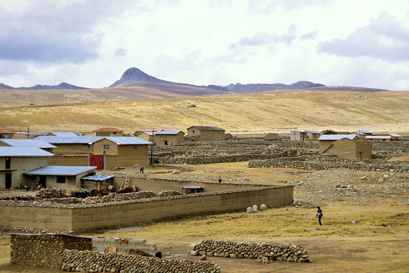
Looking east from Junín, a town south of Lake Junín, there are several rocky peaks beyond rolling hills covered with highland grasslands. The high peaks of Central Cordillera of the Andes lying east of the Bombón Plateau do not appear so high from the Junín Plain *1) at an altitude of 4,100 m. The high mountain in the photo is Cerro Rispanga, a rocky peak at an altitude of 4600m. The Mt. Chipián (4,751 m above sea level), which PanoraGeo recognizes as the source of the Amazon River, is also such a rocky peak. Mt. Chipián rises over the rolling hills that continue outside the right frame of this photo. (See:Mt. Chipián, the source point of the Amazon River, seen on Google Street View. )。
The gentle hills in the foreground are moraines left behind by glaciers that flowed from these high peaks during the glacial period, and are made up of gravel and rock masses of various sizes. In some places, large rock masses are exposed in the ichu grass meadows that cover the hills. This highland grassland, which corresponds to the Puna zone in the geographical altitude zone of the Peruvian Andes, was mainly grazing, but potatoes were also grown in nearby fields.
*1) Pampa de Junín is part of the Bombón Plateau, a plain that stretches southeast of Lake Junín. In 1824, the Battle of Junín, which decisive the victory of the Peruvian War of Independence, was fought, and the Chacamarca Obelisk commemorates this battle.
Photographed on July 27, 1986 Camera position; (Latitude and Longitude):-11 9 50.10, -75 59 20.12 (Google Map) Shooting direction: 55°clockwise from north
PanoraGeo-No.739
Photo used in No.28 Follow the Immense River, the Amazon P.4